 These DXpeditions are a passion project led by #TeamTopLeft to help other radio amateurs log contacts to maidenhead grid square CN78, a sparsely populated destination in the Pacific Northwest.
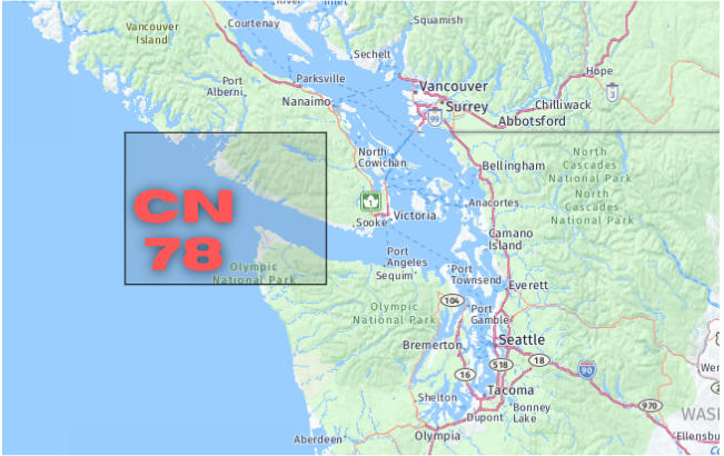
CN78 has the distinction of being the furthest top left grid of the continental United States. It is also a rare grid for anyone chasing the Fred Fish Memorial Award (FFMA) by confirming 6M QSOs with all 488 grid squares that include any part of the continental United States.
Several years ago, Barry Hansen (K7BWH) and Rod Johnson (WE7X) took a 650 mile trip across the Olympic Peninsula to active CN78 and detailed their trip in an article for ARRL’s QST Magazine. Their goal was to activate the remote lowland coastal grids of the peninsula during the VHF contest in the dead of winter. Barry called CN78 “the single most difficult grid square” of the trip. You can read their story here.
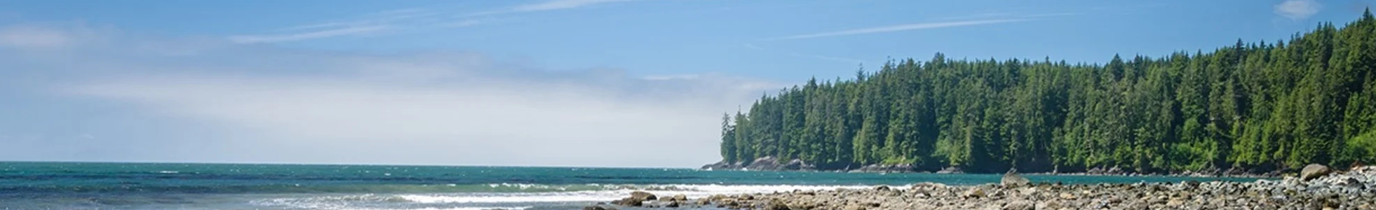
Grid CN78 spans the Strait of Juan de Fuca that separates the Olympic Peninsula in Washington State from the west coast of Vancouver Island in British Columbia.
On the Northwest tip of CN78 lies Ucluelet (pop 1,717), a resort destination at the western edge of Barkley Sound, 288 km (179 mi) northwest of the British Columbia provincial capital, Victoria. Ucluelet means “people of the safe harbour” in the Nuu-chah-nulth (Nootka) language. In 1870, fur sealers came to the area seeking ports for vessels working the Bering Sea sealing grounds and established a trading post in Ucluelet harbour. Now, Ucluelet is a hotspot for storm watching, fishing, and outdoor activities.
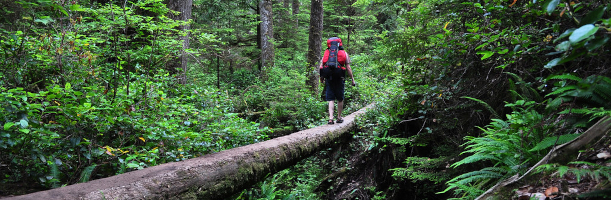
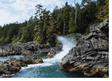
South along the coast is the Pacific Rim National Park Reserve. The park is an important link in the 75 km (47 mi) West Coast Trail, part of the ancient paths and paddling routes used for trade and travel long before Europeans arrived on Vancouver Island. As the years passed and the number of ships sailing the Juan de Fuca Strait increased, so too did the number of shipwrecks and drownings along the coast. In time, the coastline became known as “the Graveyard of the Pacific.” Once settlers arrived, they turned the roads into trails to assist with recovering shipwrecked sailors.
Now, the West Coast Trail is an iconic backcountry, multi-day backpacking trail that is a bucket list challenge for many hikers. Hikers climb more than 100 ladders with a heavy pack, trudge through deep mud, wade through mountain-fed rivers in fast-flowing hip-deep waters, and push through whatever weather the wild West Coast delivers — often driving wind and rain.